Headline photo

Headline photo
Rockcliffe and Kippford from South Glen Brae: Ed Iglehart [CC-BY-SA-2.0 (www.creativecommons.org/licenses/by-sa/2.0)], via Wikimedia Commons

Introductory text

Kippford and Rockcliffe are on the East Stewartry Coast, an unspoilt National Scenic Area with two other NSAs in close proximity. It is in Dumfries & Galloway, South West Scotland, a region known for it's wonderful scenery, biodiversity, turbulent history, smugglers and black and white 'belted' cattle known as Galloway Belties. This stretch of coastline has many names. Known locally as the Colvend Coast or the 'Secret Coast' (due to the peace and tranquility) it is often referred to as the 'Scottish Riviera' due to it being the holiday resort of choice for Victorian millionaires and having a Gulf Stream influenced microclimate: evidenced by palm trees in some gardens. Castle Douglas, the food town is a short drive away and Kirkcudbright, the Artists Town is over the next headland.


This a scenic and unique part of the world and we started the blog to share the experience of living in this wonderful place. We hope that it will be of interest to others who live here and give those planning to visit the area a taste of all it has to offer.


The blog has a correspondent in both Kippford and Rockcliffe village, you can also follow their Twitter feeds on the right of the page. If you would like to get involved we look forward to hearing from you.

Tuesday 21 August 2012

A visit to Rough Island Bird Sanctuary: National Trust for Scotland

To me, what makes the Urr Estuary so pretty and distinctive is not only the backdrop of hills (the highest in the area being Screel) but also the two small islands just sitting off shore.

Hestan, the larger of the two has a lighthouse and is the furthest from Rockcliffe and Kippford. Rough Island is the closest to the two villages and is an 8 hectare bird sanctuary; part of the 120 acres owned and managed around Rockcliffe and Kippford by the National Trust for Scotland. The NTS owned areas around Rockcliffe can been seen marked in lilac on this OS map. They are chiefly along the coast to the North West and South East of the village, including Rough Island Bird Sanctuary and described by the NTS as:

" A network of small paths, running through a mosaic of woodland, meadow and heather-topped granite outcrops, offer walkers fantastic views out to Rough Island and the Solway."

 More information can be found here: NTS Rockcliffe

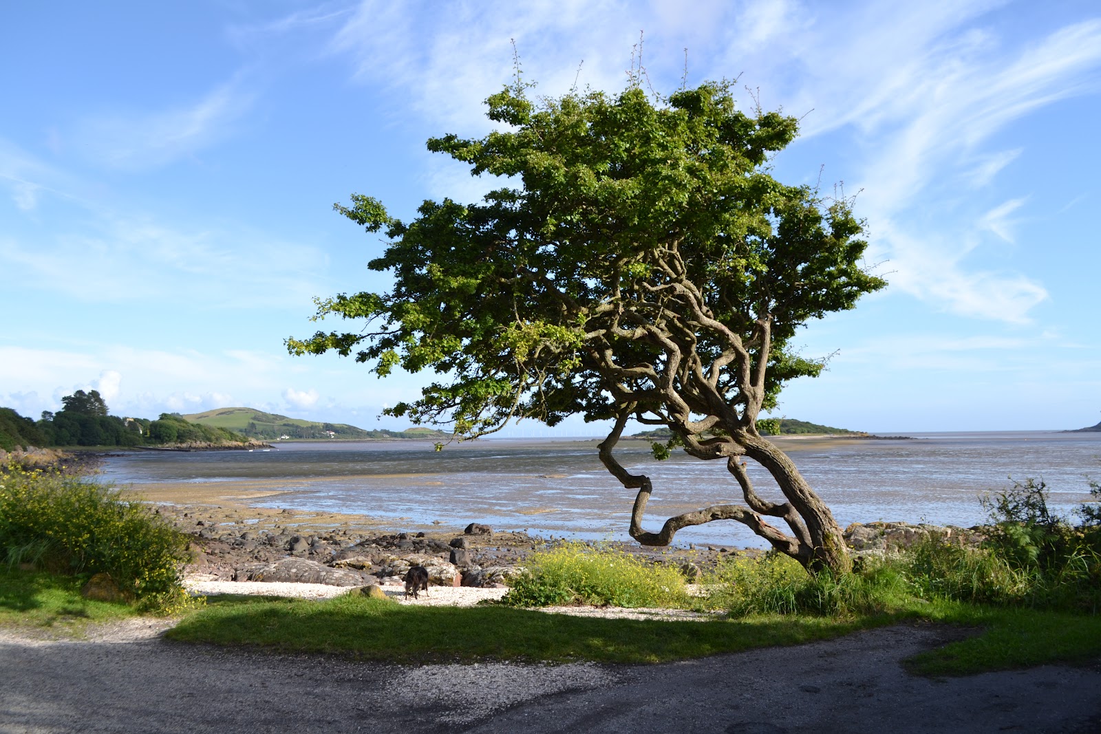
Looking towards Rough Island and Castle Point from Kippford
The National Trust for Scotland protect this acreage and care for the meadows. Their management of these i.e. cutting, raking and grazing. (You will see Highland Cattle grazing the meadow near the Mote of Mark in the Winter months ) over a period of time has resulted in a rich and diverse mix of wildflowers and grasses. In turn these meadows are the home to many mammals, birds and invertabrates. 

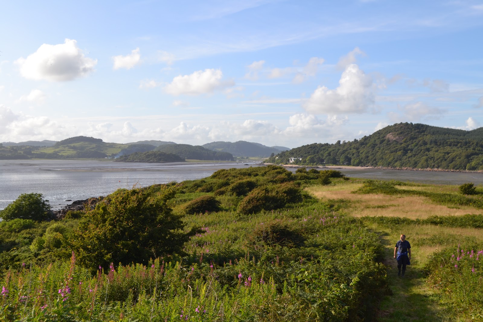
These photographs were taken on an evening walk out to Rough Island in early August. We always look forward to the end of the bird breeding season when it's OK to walk out there at low tide. (Always check the tides before setting off as they come in very swiftly)

(PLEASE NOTE:To prevent disturbance to courting,nesting and breeding birds please do not visit the island during May, June and July.)

Shell Beach at Kippford
Although you can wade through the mud direct from Rockcliffe beach, there is a causeway across to the island which runs from the shell beach along from Rough Firth, Kippford. You can see the causeway in the photo below. I have been accused in the past of only photographing the area with the tide in. I think its just as beautiful with the tide out as it takes on a different beauty. It's this dynamic vista that makes the area so appealing. 
Causeway to Rough Island

A big feature of the Estuary is the intertidal mud flats created by sediment washed in from the sea. This mud is inhabited by a large number of invertabrates which adapt to live in this environment. Its these worms crabs and shellfish that provide a meal for ducks and waders.

Looking from Rough Island towards Rockcliffe
Once on the island, thanks to the diligence of the NTS, it is pleasant to stroll up the spine of the island to the stone cairn, a jumbled pile of rocks assembled, no doubt, by many generations. This is a lovely spot to sit and look out to Hestan Island, Castle Point and across to the Cumbrian Coast with the peaks of the Lake District behind. Hidden in the cairn is a (pre-Geocaching) time capsule, a battered biscuit tin full of pens, notes, tickets, business cards etc., that you can add your own messages to or leave small mementoes in. The children love it so if you discover it please make sure it is left intact and sealed for others to discover and enjoy.

From the cairn, Rough Island: the Urr Estuary towards Kippford with the Muckle to the Right
From the cairn, Rough Island; looking North West
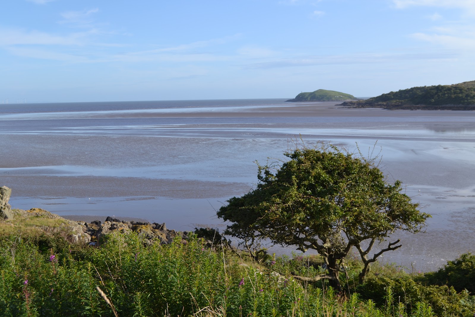
From the cairn, Rough Island; Hestan Island


The Island is an important place for nesting waders due to its limited accessibility resulting in less disturbance for nesting birds. On the Island's beaches Oystercatchers and Ringed Plover scrape out shallow depressions in order to nest and can lay up to four eggs. In order to protect these birds, whose eggs are hard to spot amongst the pebbles and shingle, it is not permitted to visit the  the Island in May, June and July.

The National Trust for Scotland is a charitable organisation with its aim to promote, conserve and manage Scotlands natural and cultural heritage. You can find out more and can join at:


All photographs taken with my Nikon. Copyright L. Birdsall
Source: Mudflats to Meadows Rockcliffe Dumfries and Galloway produced by National Trust for Scotland

Thursday 2 August 2012

Rockcliffe to Castlehill Point: A walk for spectacular views over the Solway


Rockcliffe to Castlehill Circular Walk 
2 miles allow 1hr to 1.15 hrs
Footwear: Sturdy/walking boots or wellies when it's been raining.


This is a pretty walk where you follow the coast so you have great views at all times. I did it at 7pm and the sun came out. The wild flowers were beautiful. The path was a little slippy underfoot, but it had been a wet day. Not my best photography as taken with a phone. I will get my new camera out next time.
Sign Post to Castle Point in Rockcliffe village


Park at Rockcliffe car park (free parking GR852535) and turn left down the road past the take away tea shop/ antiques. Just before the bay opens out in front of you turn left down the Merse - private road pedestrians only. You will see a sign post for Castle Hill 1 mile.


Rockcliffe and wild flowers
Near the end of the Merse (tarmac road), as the road turns  left and goes uphill, take the little path off to the right signposted Castle Point (see photo below).
Scottish National Trust Trail to Castle Point
As you walk along this stretch there are plenty of little paths off to the right to the shore and a few lovely benches to sit and admire the view over the Solway.

Hestan Island
Carry along this path and over wooden foot bridge (below). The path then splits take to path to the right so you are close to the shore.


At low tide you may see Mallard and  Wigeon. Along with various waders like Oystercatcher, Redshank and Curlew.

The path then opens out on a peeble beach but follow the curve around and head towards Port O' Beagle cottage and you will pick up the path again.


Back in to an area of hedgerow follow coastal path (you will see a few paths going up left ignore these thse bring you along the gravel lane to the camp site, the route we take back to the village)

Nelsons Grave


The story behind the grave of Joseph Nelson, which lies adjacent to the shore path (OS Map ref NX 852 528) is told in the History of Galloway dated 1841: -

'At the mouth of the Urr the headland of Castle Hill stands out boldly, bearing on its summit vestiges of an old Norse fortress. Here, in January 1791 a smuggling vessel from the Isle of Man went ashore and all hands were lost. Only one body, that of Joseph Nelson of Whitehaven, was cast up the following July. It was buried where it was found and where later his widow caused a stone to be erected'


Joseph Nelson was 69 years old and was buried on the shore rather than a cemetery as he was believed at the time to be a smuggler. Later his wife placed the gravestone in his memory.

Just after Nelsons Grave go through Kissing Gate and up small incline to the meadow.
Castle Hill Point


Where the path joins the meadow you can see Castle Point to your right. Head right towards it keeping to the edge of meadow to avoid damage to the grass or frightening any livestock that may be grazing. If there is livestock please keep any dogs under close control.

View South Eastward to Hestan Island


Castle Hill is the site of an ancient fort which was occupied in the iron age. You can see the mountains in the Lake District, St. Bees Head and the Isle  of Man on a clear day from here.
Grid Ref NX8552


View from Castlehill Point
The sure of foot may want to pass though the kissing gate and scramble down the path to the pebbled visible beach below. It's a bit of a pull back up but well worth it! 

To return back to Rockcliffe, retrace your path back to the edge of the meadow and at the point where you entered meadow carry along the edge of the field and through a gate. Please make sure all gates are closed. Follow the road past a few houses and through the caravan site. After a small slope at a small bridge where the gravel road turns to tarmac either turn left and you will be back at the wooden bridge along the path near the coast and follow the path back to village. Or carry straight on Barcloy Road until you join the road in to Rockcliffe and turn left down the hill back in to the village.
Around the meadow Rockcliffe in the distance
As always all images are copyright of the blog writers. Please do not use or reproduce them without permission. Thank you.