Headline photo

Headline photo
Rockcliffe and Kippford from South Glen Brae: Ed Iglehart [CC-BY-SA-2.0 (www.creativecommons.org/licenses/by-sa/2.0)], via Wikimedia Commons

Introductory text

Kippford and Rockcliffe are on the East Stewartry Coast, an unspoilt National Scenic Area with two other NSAs in close proximity. It is in Dumfries & Galloway, South West Scotland, a region known for it's wonderful scenery, biodiversity, turbulent history, smugglers and black and white 'belted' cattle known as Galloway Belties. This stretch of coastline has many names. Known locally as the Colvend Coast or the 'Secret Coast' (due to the peace and tranquility) it is often referred to as the 'Scottish Riviera' due to it being the holiday resort of choice for Victorian millionaires and having a Gulf Stream influenced microclimate: evidenced by palm trees in some gardens. Castle Douglas, the food town is a short drive away and Kirkcudbright, the Artists Town is over the next headland.


This a scenic and unique part of the world and we started the blog to share the experience of living in this wonderful place. We hope that it will be of interest to others who live here and give those planning to visit the area a taste of all it has to offer.


The blog has a correspondent in both Kippford and Rockcliffe village, you can also follow their Twitter feeds on the right of the page. If you would like to get involved we look forward to hearing from you.

Monday 25 March 2013

Making the most of a snowy weekend

This week-end has been a real treat: Being at sea level we don't usually get much snow along the Colvend Coast and so  we got out there and enjoyed it!

Although areas over higher ground had more, in Kippford, Rockcliffe and Sandyhills we had about 6 inches of lying snow with drifts to around a foot high. On Friday we were snowed in after heavy, constant snowfall throughout the day but, not to be deterred (and having an impatient collie reminding us it was time for 'walkies') we got togged up and walked along a snow covered, almost traffic free A710, then out over the sands at low tide. It was bracing to say the least but very exhilarating. We felt a bit like Scott in the Antarctic as on the return we were walking into biting winds and falling snow but hot chocolate and a good movie curled up on the sofa afterwards made a great reward.

Saturday was overcast and felt very cold due to the strong winds but as the roads had cleared a bit we just wrapped up warm and snug and headed out for RSPB Mersehead.

Due, no doubt, to a desperate search for food we had good views of Snipe, Fieldfare, Redwing, Mistle Thrushes, Blackbirds and of course the geese. This video clip shows a very excited collie on the beach enjoying the expanse of virgin snow. Yes, it was pretty windy but not nearly so bad as the sound on the video clip suggests!


On Sunday things were very different, the roads were clear and we had a bright sunny day so a walk around Rockcliffe was in order. Here are a few of the photos!

Very artistic!
The glorious yellow and coconut/vanilla scent of the Gorse contrasted beautifully with the crisp snow and blue skies and made a memorable sight.

The snow doing it's best to blanket the Gorse blooms

Rockcliffe beach doing a good impersonation of a Christmas card
The dogs had a great time racing around on the beach but poor Hamish (a Sproodle puppy) had problems with snow balling up in his fur so had to be carried home for an early bath!
Looking across to Rough Island with Rascarrel in the background
One of the great things about walking the dogs in the snow is that instead of having to wash off mussy paws or brush sand out of long coats they come back clean and sweet smelling. Just a brisk rub with a towel and they're done.

Walking in the snow is soooooooooooo exhausting!
However, it's not been good for everyone this weekend. I know that there will be many people across the region, especially those living further West in places like New Galloway and Newton Stewart, gnashing their teeth reading this, as roads have been closed and many homes have been without power. Our sympathy goes out to them as they have has a difficult time (particularly those caring for livestock which is never easy in deep snow). Also birds and wildlife will have suffered. We have reports of a Little Egret casualty along the frozen shores around Kirkcudbright Bay which is a real shame. 

Here along the the Colvend Coast we were lucky to have just enough snow to make it picturesque, so we got out there and made the most of it. It's thawing rapidly now and the roads are clear with traffic moving easily so it's back to normal!

© All images and video subject to copyright - not to be reused, copied or altered without written permission

Tuesday 12 March 2013

Mull of Galloway: just had to share this fantastic story


'Scotland's Land's End'

nature reserve plan 

backed by locals


Mull of Galloway
The Mull of Galloway Trust balloted residents in the area, garnering 98% support
Scotland's most southerly tip could become a nature reserve after local residents almost unanimously backed a proposed community buy-out.
A local trust is confident of raising the £300,000 asking price for the Mull of Galloway, mainly through the government's Scottish Land Fund.
The Northern Lighthouse Board is selling the 30-acre site as part of an asset disposal programme.
Its lighthouse tower is not included in the sale and will continue to function.
RSPB Mull of Galloway
The lighthouse tower is not part of the sale and will continue to function
The Mull of Galloway Trust was set up to secure the site, which includes cottages and other buildings, as a nature reserve and tourist attraction.


However, it needed to demonstrate community support to attract funding.
In a ballot of 541 local residents, 347 votes were cast, with only three voting against the proposal and two papers being spoiled.
That represents 98.5% support on a 63.8% turnout.
The trust's next step is to prepare a business plan and formal funding application.
It has said it wants to preserve the area as "a place of beauty", "a place of tranquillity" for locals and visitors and to avoid any possibility of commercial exploitation of "Scotland's Land's End".

Source: http://www.bbc.co.uk/news/uk-scotland-south-scotland-21741256

Saturday 9 March 2013

A great walk for spectacular views: Mark Hill, Rockcliffe

Spring is here so it's time to dust of your walking boots and get out there.
We highly recommend this walk to guests at the start of their stay, especially if they are new to the Colvend Coast, as it gives you a really great view of the local area so you can orientate yourself.


Mark Hill Walk - Forestry Commission Scotland

Kippford and the Urr Estuary From Mark Hill

Time  - allow about 25 min's each way and time to take in the view.
Distance Approx 2 Miles
Shoes - sturdy, comfortable.
Difficulty - Moderate, A short walk on forestry paths but rough terrain and steep, rocky path up and down Mark Hill. Path made up of gravel road, wood chip, rocks, boulders. Muddy in Winter

Why do it - Amazing view


Rockcliffe and Castle Hill Point from Mark Hill

Start: From Rockcliffe car park turn left down the road (footpath) and walk down the hill towards the beach. Follow the road and go about threequarters of the way around the curve of the bay.

  Where a lane joins the road at a 90ยบ angle, turn right (signposted to Barons Craig Hotel) and then left at the T junction towards the Barons Craig Hotel (closed this year for maintenance ). 

Walk along the path flanked by stone walls until you come to a 5 bar gate and clearing in the woods.

Here you have four other path choices, you need to take the third exit. First left takes you to the Mote of Mark, second left (straight on) is the Jubilee Path to Kippford. Take the next path which is a gravelled forestry road (3rd Exit ) to the left of this road there is a Forestry Information Board with the Mark Hill Walk outlined on it. This walk detailed on the board is longer and two miles from this point. Great for the more energetic.

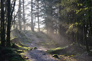
Forest Path opening out at Mark Hill
Walk up the Forestry Road about 4 min's (few hundred yards) and at the blue marker on the left turn left  again on a forestry road. As I write this there is a lot of work being done on these roads  but the work should be completed soon. Please adhere to all route closures and diversions for your own safety.

Blue Forestry Marker and Path to Mark Hill
Walk up this hill for about 10mins and you will see a small path leading in to the forest. Turn left at blue marker in to the Fir trees

A beautiful February Day
The path starts to get a bit rocky and a bit of a pull but you will soon be rewarded by the view.
West to Glen Isle
At the top of the hill follow the plateau to the left (South) and it will start to go downhill. This path is quite rocky so take care. Once at the bottom you join the Jubilee Path and can turn left back to Rockcliffe and the car park or right towards Kippford.

Jubilee Path towards Rockcliffe
 All photographs copyright - © L Birdsall, Millbrae House

The first sign of Spring at Sweetheart Abbey

Last week I spotted what must be the first signs of Spring: a people carrier full of visitors getting out of their vehicle at Sweetheart Abbey! 

I was driving to Dumfries on a glorious, clear, crisp Spring day and has chosen to take the coast road (the A710), which is my favourite route as the scenery is stunning, when I spotted them as I turned the bend next to the Abbey Tea Room in New Abbey.

How did I know they were visitors? Well the walking gear, cameras and binoculars were a hint, but the reason they caught my eye was that, even whilst getting out of their vehicle, they were already staring with wonder and awe at the towering red sandstone walls of the Abbey. 

View of Sweetheart Abbey from the carpark next to the tearoom

Their total focus was the amazing and evocative building in front of them, everything else was being done on auto setting. It reminded me of my first sight of this amazing place, not without a whiff of nostalgia I have to add, and reminded me that it is easy to take these spectacular places for granted and to forget that unique feeling you get when seeing something truly amazing for the first time. I have to admit I felt envious of them experiencing the Abbey, for probably, the first time.

And Sweetheart Abbey really is amazing as it is a place of personal devotion and a monument to the love of one person for another. 


In 1268, Lord John Balliol, husband of Lady Dervorgilla of Galloway, died. His grieving widow had his heart embalmed and placed in an ivory casket which she carried with her constantly.

Lady Dervorgilla undertook many charitable acts in his memory but the most significant must be founding of the Cistercian abbey of Dulce Cor (Latin for ‘Sweet Heart’) in 1273. When 
Lady Dervorgilla died in 1289, she was laid to rest in front of the abbey church’s high altar, with her husband’s heart to her bosom.

View of Sweetheart Abbey from a distance
Sweetheart Abbey’s conception as a shrine to human and divine love is a deeply appealing concept as is its attractive, rural village setting. The imposing ruin nestles between the grey bulk of Criffel to the West and the shimmering waters of the Solway Firth to the South, whilst its dark red sandstone walls contrast with the lush grass of the pastureland at their feet.

For more information on Sweetheart Abbey follow these links:
Historic Scotland - access information and prices

History and background

As Spring is definitely here it's a good time to be thinking of getting out and about with the walking boots on so the next post is a great walk for orientating yourself along the Colvend Coast, great views and yes, a bit of a climb, but well worth it!