Headline photo

Headline photo
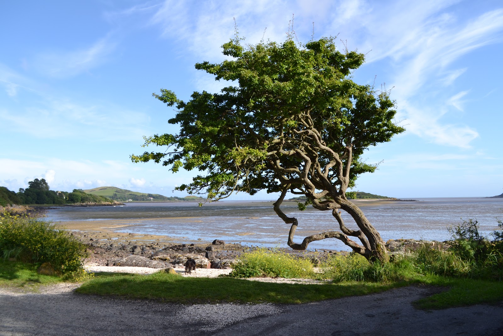
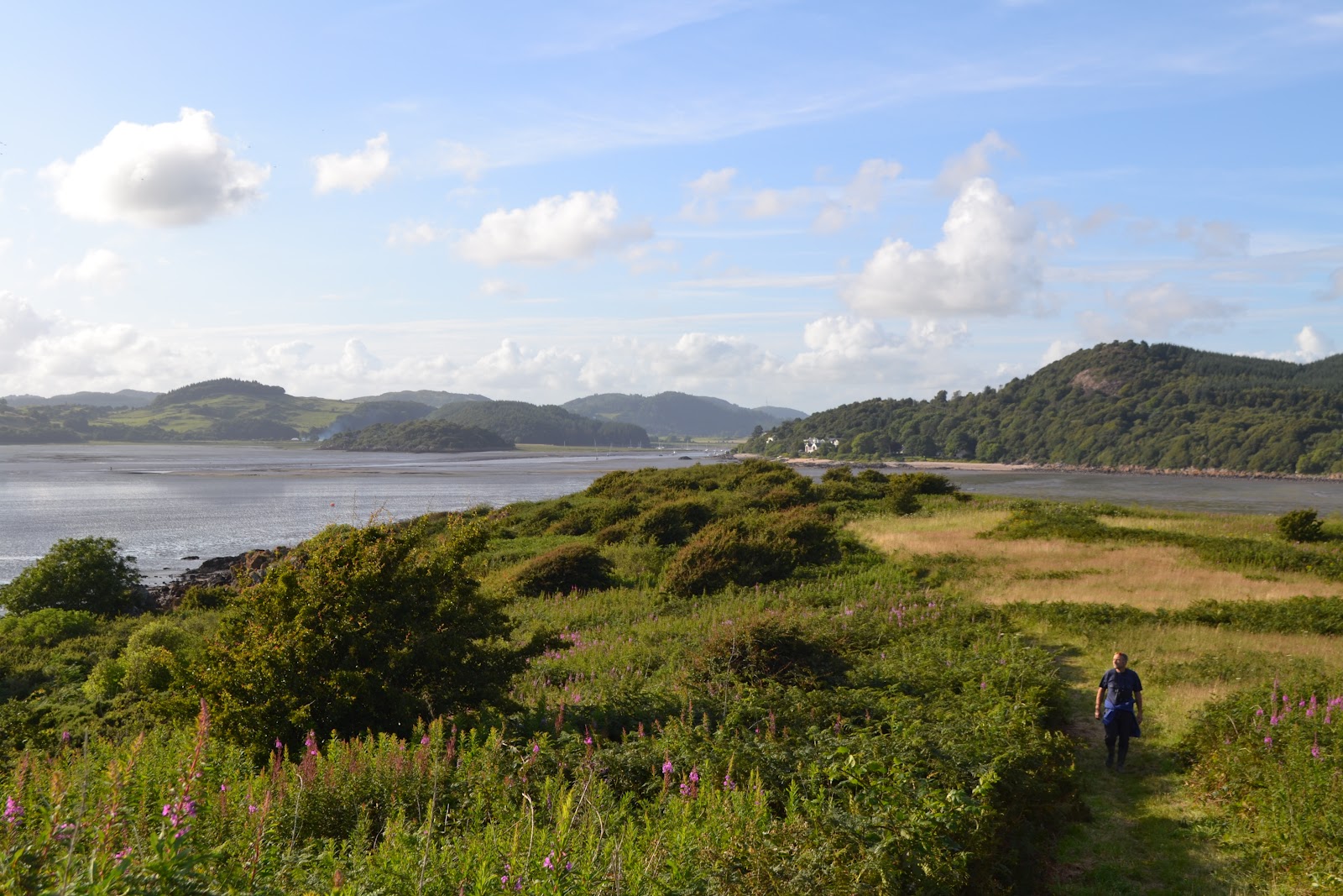
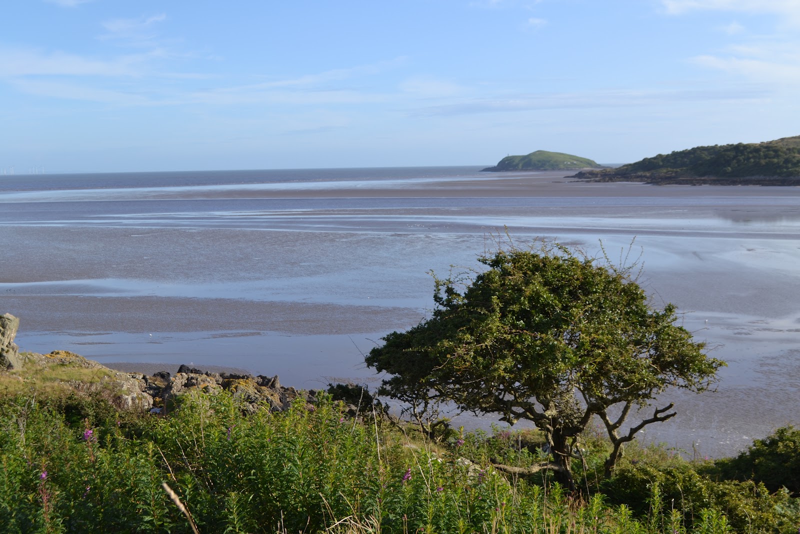
Rockcliffe and Kippford from South Glen Brae: Ed Iglehart [CC-BY-SA-2.0 (www.creativecommons.org/licenses/by-sa/2.0)], via Wikimedia Commons

Introductory text

Kippford and Rockcliffe are on the East Stewartry Coast, an unspoilt National Scenic Area with two other NSAs in close proximity. It is in Dumfries & Galloway, South West Scotland, a region known for it's wonderful scenery, biodiversity, turbulent history, smugglers and black and white 'belted' cattle known as Galloway Belties. This stretch of coastline has many names. Known locally as the Colvend Coast or the 'Secret Coast' (due to the peace and tranquility) it is often referred to as the 'Scottish Riviera' due to it being the holiday resort of choice for Victorian millionaires and having a Gulf Stream influenced microclimate: evidenced by palm trees in some gardens. Castle Douglas, the food town is a short drive away and Kirkcudbright, the Artists Town is over the next headland.


This a scenic and unique part of the world and we started the blog to share the experience of living in this wonderful place. We hope that it will be of interest to others who live here and give those planning to visit the area a taste of all it has to offer.


The blog has a correspondent in both Kippford and Rockcliffe village, you can also follow their Twitter feeds on the right of the page. If you would like to get involved we look forward to hearing from you.

Sunday, 16 September 2012

Shambellie Autumn Fair - update

A date for your diary...

You are invited to an Autumn Fair at Shambellie Walled Garden and Nursery (New Abbey) on Saturday 22nd September.


Image courtesy of: http://www.shambelliewalledgarden.co.uk/

Shambellie Walled Garden, until 2005, a derelict and weed-choked space, (being abandoned in the 1960's) has been brought to vibrant life by dedicated enthusiasts and  is now a paradise regained and will, I am sure, prove a lovely setting for the Fair which runs from:

10.30 - 4.00pm

Apart from the lovely gardens there will be:
Floral Display Demonstrations
Hand Crafted Gifts
Vintage Finds
Home-made Notebooks
Home Produce
Bric-a-brac
Collectables
Artwork
Girt ideas... and more!

Coffee and shortbread served all day!

For more information contact: Sheila Cameron 01387 850463

ADMISSION FREE

Tuesday, 21 August 2012

A visit to Rough Island Bird Sanctuary: National Trust for Scotland

To me, what makes the Urr Estuary so pretty and distinctive is not only the backdrop of hills (the highest in the area being Screel) but also the two small islands just sitting off shore.

Hestan, the larger of the two has a lighthouse and is the furthest from Rockcliffe and Kippford. Rough Island is the closest to the two villages and is an 8 hectare bird sanctuary; part of the 120 acres owned and managed around Rockcliffe and Kippford by the National Trust for Scotland. The NTS owned areas around Rockcliffe can been seen marked in lilac on this OS map. They are chiefly along the coast to the North West and South East of the village, including Rough Island Bird Sanctuary and described by the NTS as:

" A network of small paths, running through a mosaic of woodland, meadow and heather-topped granite outcrops, offer walkers fantastic views out to Rough Island and the Solway."

 More information can be found here: NTS Rockcliffe

Looking towards Rough Island and Castle Point from Kippford
The National Trust for Scotland protect this acreage and care for the meadows. Their management of these i.e. cutting, raking and grazing. (You will see Highland Cattle grazing the meadow near the Mote of Mark in the Winter months ) over a period of time has resulted in a rich and diverse mix of wildflowers and grasses. In turn these meadows are the home to many mammals, birds and invertabrates. 

These photographs were taken on an evening walk out to Rough Island in early August. We always look forward to the end of the bird breeding season when it's OK to walk out there at low tide. (Always check the tides before setting off as they come in very swiftly)

(PLEASE NOTE:To prevent disturbance to courting,nesting and breeding birds please do not visit the island during May, June and July.)

Shell Beach at Kippford
Although you can wade through the mud direct from Rockcliffe beach, there is a causeway across to the island which runs from the shell beach along from Rough Firth, Kippford. You can see the causeway in the photo below. I have been accused in the past of only photographing the area with the tide in. I think its just as beautiful with the tide out as it takes on a different beauty. It's this dynamic vista that makes the area so appealing. 
Causeway to Rough Island

A big feature of the Estuary is the intertidal mud flats created by sediment washed in from the sea. This mud is inhabited by a large number of invertabrates which adapt to live in this environment. Its these worms crabs and shellfish that provide a meal for ducks and waders.

Looking from Rough Island towards Rockcliffe
Once on the island, thanks to the diligence of the NTS, it is pleasant to stroll up the spine of the island to the stone cairn, a jumbled pile of rocks assembled, no doubt, by many generations. This is a lovely spot to sit and look out to Hestan Island, Castle Point and across to the Cumbrian Coast with the peaks of the Lake District behind. Hidden in the cairn is a (pre-Geocaching) time capsule, a battered biscuit tin full of pens, notes, tickets, business cards etc., that you can add your own messages to or leave small mementoes in. The children love it so if you discover it please make sure it is left intact and sealed for others to discover and enjoy.

From the cairn, Rough Island: the Urr Estuary towards Kippford with the Muckle to the Right
From the cairn, Rough Island; looking North West
From the cairn, Rough Island; Hestan Island


The Island is an important place for nesting waders due to its limited accessibility resulting in less disturbance for nesting birds. On the Island's beaches Oystercatchers and Ringed Plover scrape out shallow depressions in order to nest and can lay up to four eggs. In order to protect these birds, whose eggs are hard to spot amongst the pebbles and shingle, it is not permitted to visit the  the Island in May, June and July.

The National Trust for Scotland is a charitable organisation with its aim to promote, conserve and manage Scotlands natural and cultural heritage. You can find out more and can join at:


All photographs taken with my Nikon. Copyright L. Birdsall
Source: Mudflats to Meadows Rockcliffe Dumfries and Galloway produced by National Trust for Scotland

Thursday, 2 August 2012

Rockcliffe to Castlehill Point: A walk for spectacular views over the Solway


Rockcliffe to Castlehill Circular Walk 
2 miles allow 1hr to 1.15 hrs
Footwear: Sturdy/walking boots or wellies when it's been raining.


This is a pretty walk where you follow the coast so you have great views at all times. I did it at 7pm and the sun came out. The wild flowers were beautiful. The path was a little slippy underfoot, but it had been a wet day. Not my best photography as taken with a phone. I will get my new camera out next time.
Sign Post to Castle Point in Rockcliffe village


Park at Rockcliffe car park (free parking GR852535) and turn left down the road past the take away tea shop/ antiques. Just before the bay opens out in front of you turn left down the Merse - private road pedestrians only. You will see a sign post for Castle Hill 1 mile.


Rockcliffe and wild flowers
Near the end of the Merse (tarmac road), as the road turns  left and goes uphill, take the little path off to the right signposted Castle Point (see photo below).
Scottish National Trust Trail to Castle Point
As you walk along this stretch there are plenty of little paths off to the right to the shore and a few lovely benches to sit and admire the view over the Solway.

Hestan Island
Carry along this path and over wooden foot bridge (below). The path then splits take to path to the right so you are close to the shore.


At low tide you may see Mallard and  Wigeon. Along with various waders like Oystercatcher, Redshank and Curlew.

The path then opens out on a peeble beach but follow the curve around and head towards Port O' Beagle cottage and you will pick up the path again.


Back in to an area of hedgerow follow coastal path (you will see a few paths going up left ignore these thse bring you along the gravel lane to the camp site, the route we take back to the village)

Nelsons Grave


The story behind the grave of Joseph Nelson, which lies adjacent to the shore path (OS Map ref NX 852 528) is told in the History of Galloway dated 1841: -

'At the mouth of the Urr the headland of Castle Hill stands out boldly, bearing on its summit vestiges of an old Norse fortress. Here, in January 1791 a smuggling vessel from the Isle of Man went ashore and all hands were lost. Only one body, that of Joseph Nelson of Whitehaven, was cast up the following July. It was buried where it was found and where later his widow caused a stone to be erected'


Joseph Nelson was 69 years old and was buried on the shore rather than a cemetery as he was believed at the time to be a smuggler. Later his wife placed the gravestone in his memory.

Just after Nelsons Grave go through Kissing Gate and up small incline to the meadow.
Castle Hill Point


Where the path joins the meadow you can see Castle Point to your right. Head right towards it keeping to the edge of meadow to avoid damage to the grass or frightening any livestock that may be grazing. If there is livestock please keep any dogs under close control.

View South Eastward to Hestan Island


Castle Hill is the site of an ancient fort which was occupied in the iron age. You can see the mountains in the Lake District, St. Bees Head and the Isle  of Man on a clear day from here.
Grid Ref NX8552


View from Castlehill Point
The sure of foot may want to pass though the kissing gate and scramble down the path to the pebbled visible beach below. It's a bit of a pull back up but well worth it! 

To return back to Rockcliffe, retrace your path back to the edge of the meadow and at the point where you entered meadow carry along the edge of the field and through a gate. Please make sure all gates are closed. Follow the road past a few houses and through the caravan site. After a small slope at a small bridge where the gravel road turns to tarmac either turn left and you will be back at the wooden bridge along the path near the coast and follow the path back to village. Or carry straight on Barcloy Road until you join the road in to Rockcliffe and turn left down the hill back in to the village.
Around the meadow Rockcliffe in the distance
As always all images are copyright of the blog writers. Please do not use or reproduce them without permission. Thank you.

Saturday, 21 July 2012

Short Rockcliffe Walk to Mote of Mark

Mote of Mark Circular - Rockliffe Short Walk 

(Allow 30 to 40 Minutes - with ice cream stop)


Start at Rockcliffe car park
Road winding down to bay - Rockcliffe
From the car-park (free parking) turn left and walk downhill towards the beach and around the pretty bay to a small area of 20min parking and public toilets. Turn right up a small path to left of toilets to first metal kissing gate after gate turn left and then right through another kissing gate in to Rockcliffe Meadow.
National Trust Scotland Rockcliffe
When path opens out at corner of meadow take worn path straight ( as gravel path turns left) on so you are crossing meadow and head towards wooden footbridge across burn.
The meadows are managed by the SNT and support a rich diversity of grasses and wildflowers. These support many mammals, birds and invertebrates.


Cross bridge and follow path round to right to information board about the history of the Mote of Mark. The Mote of Mark is now in front of you.Continue up meadow to wooden gate.
Mote of Mark

The Mote of Mark was once a defended hilltop overlooking the Urr estuary. It was the court or citadel of a powerful Dark Age chieftain, possibly one of the princes of Rheged. Archaelogical excavations show the site was occupied during the 5th and 6th century and appears to have been destroyed by fire in the 7th century it is thought by the Northumbrian Angles.


Woodpecker Trail Rockcliffe


NTS Dark Age Fort
 Through gate and after a few feet the path splits  take the path to the left up to the top of the Mote. A bit of a climb with steps but well worth the view.

View from Mote of Mark looking SE towards Castle Point


Rough Island closest to the shore is a 8ha bird sanctuary which is accessible at low tide by foot via a causeway.  ( always refer to a local tide table before walking to the island ) The island is a bird sanctuary with nesting oystercatchers and ringed plovers and access is restricted during May and June to avoid disturbance.


Rough Island and Causeway
 Retrace your steps back down the hill and at bottom where path meets up with Woodpecker Trail turn left for a short while and then right through first wooden gate.
Woodpecker Trail Rockcliffe
 Follow Trail past Hawthorn Trees and through another wooden gate past carved Woodpecker to a point where five paths meet.

Carved Woodpecker on trail

Turn right down lane past the Barons Craig Hotel and at entrance to hotel turn right through gate next to cattle grid and back across meadow towards the two kissing gates and back to beach.

Path past Barons Craig Hotel


Low Tide - Hestan Island from Rockcliffe Bay


Ice Cream Stop


Coffee and cakes at the take away Garden Tea Room Rockcliffe
Gar.den Tea room is  close to car park andopen most days during the school holidays and sells a selection of antiques and paintings. Tea, coffee and cakes to take away or enjoy in the garden
All images copyright L Birdsall.

Tuesday, 26 June 2012

Saturday 30 June: British Pipe Band Championships 2012

We are pretty excited, as this  Saturday 30 June 2012, Annan is hosting the British Pipe Band Championships for the third year running. Dad, a big fan of the Edinburgh Military Tattoo, is going along with some of the young musicians in the family as it promises to be a great day out.

This colourful event is one of the world's most spectacular gatherings of highland music and culture. With around 130 pipe bands will competing to be British Champions at their grade in front of a crowd of 6,000 spectators.


Photo courtesy of the 

British Pipe Band Championships

 website: http://www.annanchampionships.co.uk
This year there will be lots of tasty Dumfries and Galloway food and produce on offer and more than fifty trade stands including a craft fair, showcasing the creativity and talents of many of Dumfries and Galloway's top artists and craftmakers. There will also be amusement stalls for all the family.


For lovers of pipe bands it's a lot closer than the Edinburgh Tattoo as Annan is just along the Solway Coast to the East past Dumfries and an easy drive along the A75.


Tickets purchased in advance are priced:
  • Adult  £6
  • Concessions  £4 (retired, full-time student, unemployed, under 16)
  • Family  £15 (2 adults + 2 concessions or 1 adult + 3 concessions)
For advance ticket sales click here: Tickets

Tickets will also be available on the day at the gate priced:


  • Adult £9 
  • Concessions £6 (retired, full-time student, unemployed, under 16) 
  • Under 5 Free 
  • Family £22 (2 adults + 2 concessions or 1 adult + 3 concessions)
See you there!

Wednesday, 13 June 2012

Screel walk inspires local weaver Katie Russell


Katie Russell,  tapestry weaver and keen walker hails from Castle Douglas. Earlier in the year Katie did a walk with her Dad and, as it's one of my favourites as Screel tops the view out over the Urr Estuary from Kippford, we asked her to share her experience with us for the blog.  From Kippford and Rockcliffe, the Screel walk is a short drive away along the A710 to Dalbeattie, left to Palnackie along the A711 (the road along the opposite shore). We are excited as it's our first long walk on the blog and it is especially interesting as Katie uses what she sees whilst out and about as inspiration for her work. For Katie her work, as with the walk, is a journey and so the two are symbiotic. 

Screel Walk courtesy of Katie Russell

NOTE: To get to the Forestry Commission car park at the foot of Screel follow the A711 from Dalbeattie or Kirkcudbright. (The car park is signposted south of Palnackie) 

It was easy to find the way and we arrived early, before 9am so the car park was empty. This was on a Sunday. Dad wasn't sure if we would get the walk done in the estimated time. He started in his shoes, but went back to the car to get his boots!  

The start of the walk is a gentle slope through the forest and that is easy going. 
When you come out of the forest there is a track that goes off to the left and another steep
path right beside it. Take the steep path. If you go on the first left you will end up in another forest!

Looking seaward: Kippford and Rockcliffe are top left of the photo: copyright K Russell


We realised that there were alternative paths, it depends on how adventurous you are feeling! Keep climbing the hill until you get to a bench from where you can admire the view of the bay.  We stopped there and had some water. 

You can then go straight into the forest and follow the path that is worn away, so you shouldn't get lost. Watch for tree roots if it has been raining, it is easy to stumble over them.  As you come out of the forest you will then start to see heather on the way up the hill. There will be areas that are boggy......unavoidable I'm afraid! But if you are wearing a good pair of walking boots then there should not be a problem. 

View from the summit of Screel: copyright K Russell
You keep going up until you are at the top from where you will see a fantastic view of the bay and also be able to see the cairn on the other summit on Screel. Walk over to there and then you will see more inland views over to Palnackie and Castle Douglas. 
It is advisable to take an OS map with you if you really want to be sure to identify the
places you see. My father enjoyed looking at how much of the coast line comprises of sand flats. Bengairn is the neighbouring, slightly higher hill, that is impressive and would also give great views. We contemplated it, but decided to keep that for another day.  Bengairn like Screel has heather and bracken, but will provide spectacular views also.

There are a number of paths going around Screel and it depends on how long you want to take to get to the top. If you want a short walk, then retrace your steps back the way you came. Alternatively you can follow a track down the side of Screel where the cairn is. Be advised there are rocky parts and walking poles come in useful in places! Dad managed with one, but I needed two. We found that going slowly, stopping every so often to take photos, stopping at the top and going slowly down took us back to the car park in about 3.5hrs. 


Twin Peaks: the summit of Screel: copyright K Russell
The heather and bracken was lovely in contrast to the greens of the forests.  I took a lot of photos of this and eventually worked up a sampler in wool, cotton and silk inspired by one of the images.

We startled a couple of deer that shot out onto the path in front of us.....too quick to take a photo unfortunately!
A grass snake, lots of interesting beetles and we heard a red grouse. The rock formations are interesting going up Screel and on the way down. My father took images of the rock formations and was quite interested in possibly producing watercolours from them. We came across a few people of all ages on the walk, all kitted out in outdoor gear with poles.


The stone cairn on the summit of Screel: copyright K Russell
The top of Screel is not somewhere to sit for too long if you are not wrapped up, but is excellent for photography and for the hardy, some painting and sketching.  I found the views of Bengairn and Tum Hill quiet inspiring with all the contrasting colours and textures. I will definitely come back and see the heather when it has changed in colour to give me more ideas. I would like to explore using thicker wools and possibly other coarse yarns. Although it was slightly misty in the distance this provided some inspiring images too. There were a lot of images really that could be used for all kinds of artwork. That is what I love about walking in this region. There is variety. 


This walk is particularly worth doing if you want to see the views of this region and into England. 

A photo of the weaving sampler that Katie wove inspired by the walk. Katie says "It took 

many hours of blending colours, but was worth it. Couldn't have produced that without

being inspired by the landscape." 

It was inspired by the heather, bracken, forest and sky and woven with wool, cotton and silk. copyright K Russell


 I was doing the walk as a novice! I am not an experienced hill walker at all! But it was well worth the steep climb! At present I am gathering images together from different parts of the region for one of my projects and Screel was a good starting off point.


You can find more information on Katie and her work on the kfrweaving website


Thank you Katie for sharing this with us.

Saturday, 2 June 2012

Marquees on the beach?

A big event on the Colvend Coast calender is World Oceans Week. Rockcliffe, which my Husband describes as normally like a "sleepy Enid Blyton seaside village", transforms overnight and there is a buzz in the air which usually starts when marquees are erected on the beach. The event, run by the Solway Firth Partnership is designed to raise awareness of our oceans and is great fun as well as being informative and educational.  There are interesting displays about our marvelous marine environment and lots of great activities for the children.

Rockcliffe Beach towards Heston Island

This annual event kicked off  today with a beach blitz and a bevy of like minded folk turned out. The volunteers of all ages, ably assisted by local children from Colvend Primary, were given gloves, bin bags and grabbers  and set off on a hunt for any rubbish, litter and debris on the beach.  Their mission, to get rid of unsightly rubbish and protect marinelife from the dangers of discarded plastic and fishing gear.
The event was run and organised by the Scottish National Trust and led by their local Rangers.
 The main event celebrating the Oceans, and the amazing creatures that inhabit them, is tomorrow: Sunday 3rd of June 2012 11am till 4pm on Rockcliffe Beach.

All events and activities are free of charge and this year there will be rock-pooling, guided walks, treasure hunts, puppet theatre, wildlife watching, sea shell identification, beach art and poetry that the whole family can join in.


I am really looking forward to a go at Sea Kayaking, an event run by the Galloway Activity Centre.  www.lochken.co.uk  The weather forecast looks good so I don't think I will need to pack my Kwells.

Rockcliffe Beach towards Rough Island
Scottish Wildlife Trust are also leading a coastal path walk looking for coastal plants and birds, suitable for adults and families. See you there!


Details from NTS Ranger 01556 503702


Location Rockcliffe Beach NX 847537

Solway Firth Partnership website
World Oceans Week Celebrations 2012 is supported by Awards for All, Scottish Natural Heritage, E.ON Climate and Renewables, The Scottish Book Trust and Creative Scotland and Dumfries and Galloway Council.